Brought to you by , Funkhouser Real Estate Group, , scott@HarrisonburgHousingToday.com
Tuesday, March 1, 2016

As excerpted from the Feb 27, 2016 article in the Daily News Record....
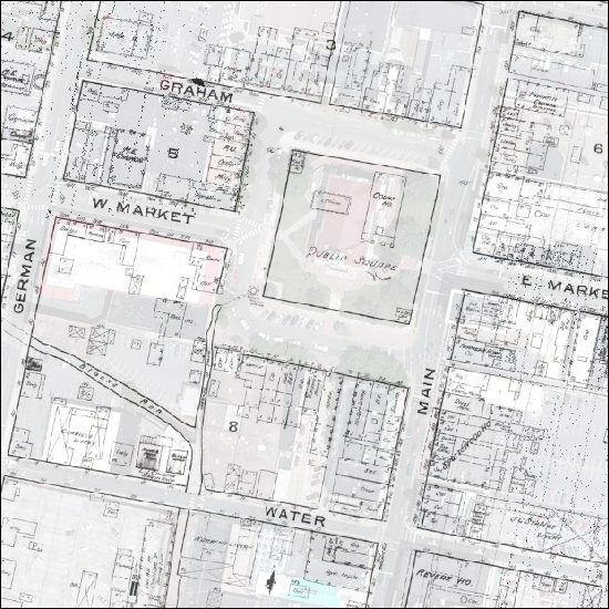
A website developed by two James Madison University staff members may teach Harrisonburg residents a thing or two about their city. [...] Visitors to the site [...] might learn Liberty Street was named German Street before World War I. They might discover a tannery once stood where the Water Street parking deck now is, or that the county courthouse was less than half its size 130 years ago.Read the full DNR article here, or start explore Harrisonburg's history via the new website....
Kevin Borg, an associate professor of history, and Bradley Andrick, geographic information system coordinator at JMU, created the website. [...] The site lets users compare satellite imagery of modern-day Harrisonburg with maps of the city from 1886, 1912 and 1930. Users can adjust the opacity of the overlaid maps to see the geographic changes over the years and read about historical points of interest.
http://www.gtsc.jmu.edu/shps/map/Enjoy!
